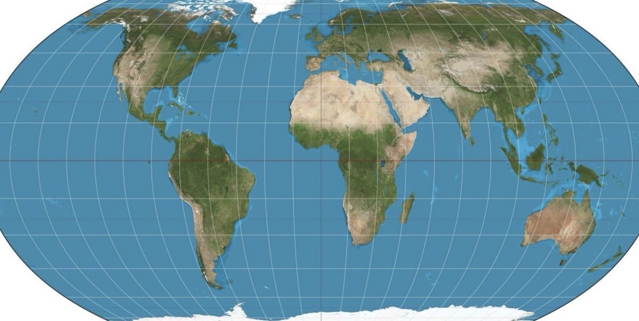

In a move as overdue as a colonial hangover, the United Nations General Assembly voted on 4 September 2026 to endorse the “Correct the Map” resolution. By a thumping 164–1, with a handful of nervous abstentions, the world formally encouraged governments, schools, publishers and tech platforms to stop treating the 16th-century Mercator projection as holy writ and start using equal-area maps, chiefly the elegant Equal Earth projection of 2018.
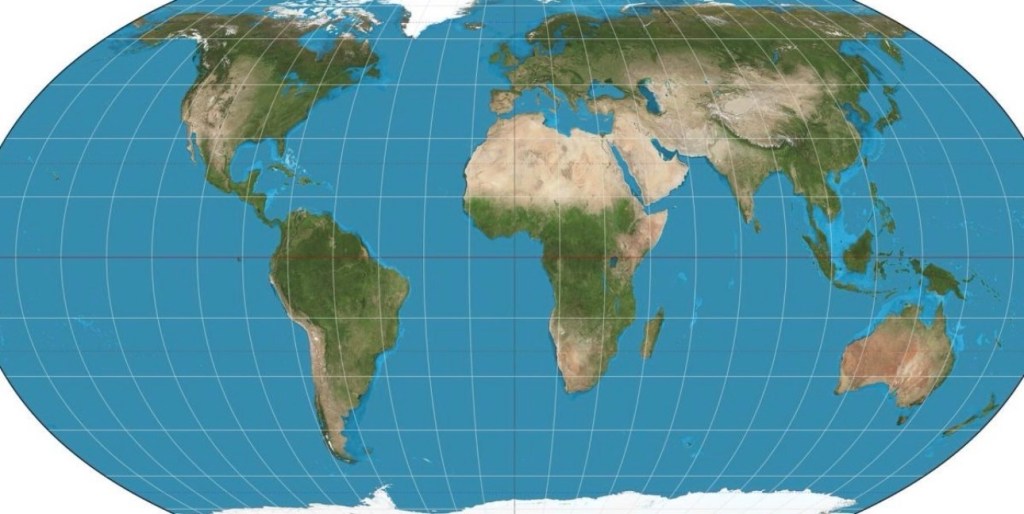
Mercator, designed for sailors who needed straight rhumb lines, has spent centuries stretching the frozen north into cartoonish importance while squeezing Africa, Latin America and South Asia into visual footnotes. On the classic Mercator, Greenland and Africa look roughly the same size. Reality is less diplomatic: Africa is about fourteen times larger. The Equal Earth projection fixes that without turning continents into abstract modern art. Africa swells to its proper bulk, Europe looks rather more modest, Greenland shrinks to something closer to its actual icy footprint, and Brazil finally gets the visual weight it deserves.
Here is the suggested new map in all its corrective glory, the Equal Earth projection, centred on the Greenwich meridian, showing landmasses at their true relative sizes:
The resolution is non-binding, of course. The UN cannot compel Google Maps to rewrite its code overnight or force your local primary school to bin its faded wall charts. But the signal is unmistakable. France has already announced it will abandon Mercator for official use. The African Union had already adopted Equal Earth earlier. And 164 nations, including the UK, India and most of the Global South lined up behind the principle that maps should stop lying about relative size.
Which brings us to the solitary “no” vote. The United States stood alone. Officially, Washington dismissed the whole exercise as a “radical ideological project” and a distraction from more serious business. Unofficially, the optics write themselves. When the rest of the planet agrees that Africa has been cartographically minimised for four and a half centuries, and only one capital objects, the isolation is rather eloquent. In an age when artificial intelligence can render the planet in any projection you please, a paper map is already half relic, half historical document. Clinging to the old distortion looks less like navigational conservatism and more like a refusal to update the mental furniture.
The vote is a damning indictment of the current American posture, one that, for many observers, sits uncomfortably close to the worldview that once casually dismissed certain African nations as “shithole countries.” There is no serious technical basis for opposing a non-binding call for more accurate area representation. The opposition therefore reads, to a large part of the watching world, as symbolic preference for a hierarchy of appearance that the rest of humanity has decided to retire.
The new map does not invent a different planet. It merely stops pretending the old one was drawn to flatter the powerful. In that sense the Equal Earth projection is not radical at all. It is simply more realistic. The world has voted, overwhelmingly, to stand with a fairer representation of Africa. Trump’s America, for the moment, has chosen to stand entirely on its own. History has a long memory for those who insist on looking at the globe through the wrong end of the telescope.

